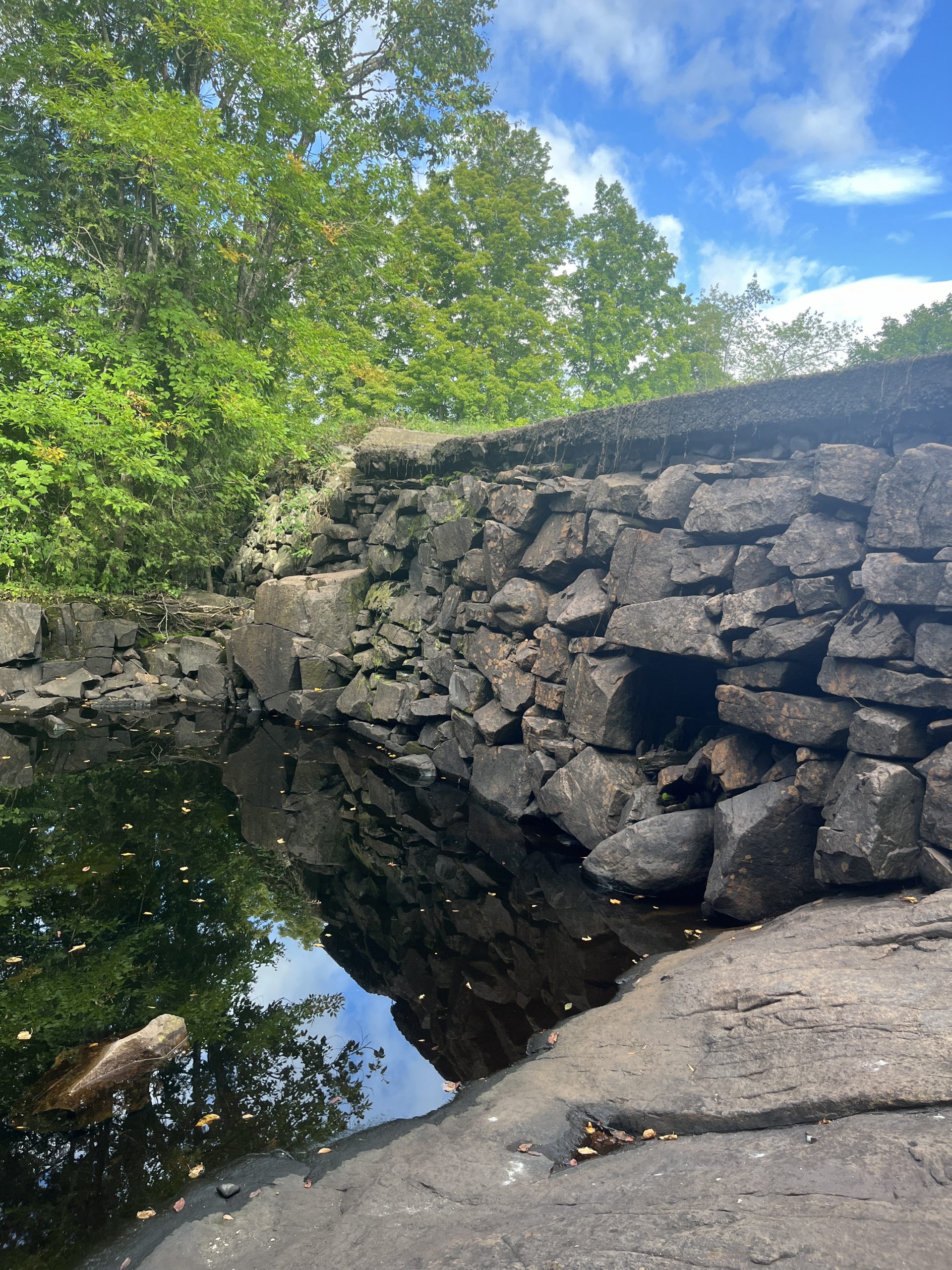
In September 2025, Natural Systems Engineering and its partners River Research and Restoration, LLC and the Onondaga Environmental Institute (OEI) completed a feasibility study for the removal of the Penfield Pond Dam, a historic dam constructed in the late 1800s to provide power for the former iron works located in Ironville, New York.
The FS was undertaken by the Town of Crown Point in response to NYSDEC inspections identifying the dam as a Grade B intermediate hazard indicating that a dam failure may result in damage to infrastructure or is likely to pose the threat of personal injury or substantial economic loss or substantial environmental damage.
The scope of the FS consisted of: 1) a Field Investigation (including preparation of a supporting Quality Assurance Project Plan) to characterize certain biological, physical and chemical characteristics of the Penfield Pond and Putnam Creek; 2) an Environmental Review to identify environmental, conservation, historic, or archaeological features that might impact a dam removal project, and 3) a feasibility assessment of a potential dam removal project with respect to criteria identified by NYSDEC (infrastructure, historic resources, and sediment management), as well as biota and cost.
Based on the scope-of-work performed, the FS indicated that significant impacts to infrastructure, historic resources or biota as a result of either a complete or partial dam removal are not anticipated. In-stream management of sediments, that is allowing impounded sediments to naturally erode and be transported downstream following either a complete or partial dam removal, appears to be the most cost-effective
means of sediment management, with few if any deleterious downstream impacts expected.
The FS also concluded that either a complete dam removal (i.e. removal of all imported dam construction materials to the pre-existing streambed elevation) or a partial demolition (i.e. removal of approximately ½ of the dam height) are feasible
removal alternatives, with a partial demolition being lesser in cost (roughly estimated at $106,000-$122,000) than that of a complete dam removal (roughly estimated at $163,000), but also not fully eliminating the risk of a future dam failure as a complete removal would. Allowing dam abutments to remain following either complete or partial removal would preserve some remnants of the historical structure for the historical site and museum associated with the project area.